
If you ever played maplestory, you would have noticed that there was a medal feature imbued in it several years ago. To achieve the complete collection of the wide array, you will have to simply fulfil the stipulated requirements and before you know it, a medal is awarded to you. You can equip the medal and brag about how much challenges you overcame before you acquire the medal. The long hours of trainings, the amount of mesos invested on the equipments and scrolls, and the amount of a-cash you spend on 2x EXP are part and parcel of your journey to the medal.

An example of a medal in Maplestory
Similarly, this week, our 97/14 Infantry Batch had undergone arduous challenges in order to make the CSB badge ours to call. The Combat Skills Badge is one of the most common badges to obtain for those posted to infantry. Seeing how abundant the badges are spreaded across the uniforms of most infanteers, it is hard for others to perceive the obstacles circumvented and to see the pride of the badge. In order for one to achieve the CSB badge, one needs to complete a 10km endurance run within 60 minutes, pass a night navigation exercise, achieve a minimum of IPPT silver, march 32km within 7 hours, cross a water obstacle, and lastly, shooting down a minimum of 5 out of 10 targets in the 100m live range.
Those requirements might seem like a huge boulder, but the trainings in OCS are built in a way to allow you acclimatize to the training gradually. For me, 32km is a gruelling ordeal that I am proud to be able to survive through it. The first 12km march around SAFTI was more tolerable compare to the remaining 20km outside of camp. Probably because I was able to estimate how long more the journey would be before we rested. After the first 12km, we had a weapon handling test. I passed it and we were allocated a bit more time to rest. The walk to the 15km mark was the killer. According to all my route marches experiences, marching 3km takes about 30-35 minutes. However, this took 10 minutes longer and we hit the 15km mark at the 42th minute. I almost died there. Being known as somebody who frequents the toilet/latrine, my 15 minute break truncated into a 1 minute rest. For the remaining of the journey, I was struggling to maintain and catch up with the pace of the main body and had to constantly run a bit here and there. At the 24km mark, we had another weapon handling test which majority of us got chided for. That was the time where I slept because the fatigue is taking its toil on my body. After that refreshing relationship with a siesta, the next 3km to the 27km mark was a breeze. Basically, I turned on zombie mode for the rest of the march.
At the 30km mark, we had to cross a water obstacle. That process itself was pretty easy, but the moment you lift your soaked bag up, you’ll feel the pinch of the extra load you have to carry. The volume of water absorbed by your bag is so high that it could easily weigh another 1 to 2kg. And with that additional stress on your back, you will proceed to the live range for a 100m shoot. To make it for the CSB, 5 targets must be shot down. The wing that went before us had a lot of failures and that stifled the confidence we had. Luckily for me, my weapon was zeroed, making my shots accurate. I scored 9/10 and upon completion of the final stretch, all of us were sent back to wingline.
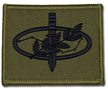
We had our badge presentation and here’s my very own badge!
The next badge in line would be the JCC badge, and the things you have to go through to name it yours is triple the difficulty for CSB. Nonetheless, I will do my best to achieve it, and by the time you know it, 12th April’s post would be about my newly named JCC badge.
Prior CSB, we had Ex. Seeker, a navigation exercise without any instructors tagging along. My detail and I had the worst experience by far for all the navigation exercise we went through.
Firstly, Sean had sprained his ankle a few days ago and was recovering then. However, halfway towards our destination, he tripped over a branch, fell and twisted that same ankle. He laid down there in pain and agony while the rest of us stood there watching him. Come to think of it now, if I was Sean, I hope nobody would be starring at me like that because I would feel uncomfortable with so many eyes on my ugly pain expressions. After Sean regained his composure and felt better, we proceeded our way to the first checkpoint.
Here’s a schematic to help you visualizers to perceive better.

The brown lines are contour lines, meaning to say the more lines you have on top of each other, the higher the ground is. From there you would be able to identify if that particular region is a knoll or a plateau, ravine or a spur. In the map I drew with paint above, there are three knolls. The one with the red X is our first checkpoint, the second one is east of the first knoll. Last but not least, the third knoll that runs horizontally south of the mentioned two knolls with a pink X. The pink X is another checkpoint we have to go through too.
The black thick lines are dirt tracks created by trekkers, runners and cyclist who frequent this park. Over time, the route they stamped and trampled on created a path where no plant can ever live there peacefully. Our initial plan was to go to the end of the dirt track and follow the green dotted path from the first checkpoint to the next. However, on our way up, two of my friends saw a clear path and assumed they would bring us to the correct location. We assumed that path and ended up reaching the checkpoint indicated by the pink X. The checkpoint with the pink X had two instructors manning it so one of us decided to ask the instructor. The instructor pointed us to head north and we’ll reach our first checkpoint. We bashed and walk and ended up on the knoll beside the intended checkpoint.
We searched for the checkpoint and couldn’t find any so we decided to backtrack. We reached the instructor’s knoll again and confirmed ground. This time, we attempted to bash in the presumed correct direction and ended up at a knoll east of the area I drew. It was the encounter with the other details that confirmed ground with us that we realized we were on the wrong knoll again. By this time, we were left with 4 hours to finish the objectives of clearing 3 checkpoints.
Time after time of going up and down knolls of varying heights, we stumbled upon this knoll. All of us agreed that this would be the last knoll and started combing for the checkpoint. Benjamin passed me the ziplock with the necessary templates to copy down the codes should me and JX found the checkpoint. Both of us explored, but the density of the vegetation showed no absolute signs of disturbances. When we headed back to convene with the others, I handled the templates and all back to Benjamin and they searched the other side.
Turns out, there were no symptoms of human invasion at all, except for those Benjamin left.
We decided to forgo the first checkpoint and proceeded to the last checkpoint (not marked in the map above). Halfway through, Benjamin dictated that we should copy down all the checkpoints we pass by in case we need to redo one more checkpoint. That was when we noticed our template went missing.
There was a heated discussion over where was the template, or who last used it. Me and JX definitely saw the template before we return it to Benjamin. We were so certain of it since 2 pairs of eyes saw it. We backtracked to the untouched knoll and search. Our efforts ended up fruitless.
We communicated back to the conducting officer and told him we lost our template, he told us to look for the last checkpoint before calling a day. By the time we hit checkpoint JOB, 500 meters away from our last checkpoint, all of us came to an agreement that both Benjamins will scout for the last checkpoint while the rest stay put.
Somehow, both Benjamins got caught by instructors and the whole detail was punished after that. The instructor then explained to us that we were not supposed to split the team up, or if we needed to, the team should be at a visual distance. Our instructor then shared his story about the demise of his JCC badge and how this 3SG, who was about to ORD in a few days time, got sent to detection barracks because of the reccee-ing.
From this navigation exercise, we might not have been the first team to clear all checkpoints like what we always do in the previous exercises, we have no doubt learnt the essentials of surviving the whole ordeal as a team. Below are the lessons I picked up from this Ex Seeker and hopefully, should this be applicable to you, experience them for yourself and empower yourself with them.
1. Overconfidence kills.
We were so confident we headed the wrong path, bashed up the wrong knoll and ended somewhere else. What is most important is to trust your inital planning routes and never give in to temptations you see (i.e. favorable route that leads to somewhere else).
2. The only thing you do when you see others is to confirm ground.
Check with the other details where their current location is. Never ever be too focused in searching for specific things the other details mentioned like your checkpoint is further down at this huge tree. Once you have decided to follow their advice, your mind will wander off your navigation process and you might be too focused on searching for the huge tree.
3. Use logic.
If you were the instructor, you would place the checkpoints that can be easily accessible by any means of transportation. If you happen to go through some portions of the jungle or forest where the vegetation is not symptomatic of human manifestations, chances are, the checkpoints are not planted there.
4. Always conduct checks, especially on things that are constantly passed around.
Otherwise, you’ll lose the template like us but the consequences suffered might be a whole lot worse in JCC, sometimes at the expense of your badge.
5. The most important thing: Teamwork
After all, you are going through this tough nut as a team. No matter what happens, as long as you give others the support they need and don’t exacerbate any bad situation, the team’s boosted morale will tide you through this rough journey.
Oh, for those who were wondering where was the template, it was at the pink X. Somehow, both JX and I saw the template after we lost it. Meaning to say, we observed a piece of non existence. Creepy eh?
We also crapped about how the three knolls formed up a bermuda triangle since we were trapped inside its circumscribed region and none of us were able to extricate the team out. Funny moments.
That’s all for this week. And I’ve got a cough to mend so readers, remember to take care of your health too!


You must be logged in to post a comment.